Lunken Airport-Stulz

image-899956-Airfields_OH_SW_htm_14909180-45c48.jpg

Lunken Airport (LUK) by Larry Stulz

 In the early 1920s, barnstorming pilots made their way across the country to earn a living.  One such pilot was Dixie Davis who started a flying business at the corner of Wilmer and Beechmont Avenues located where the Lunken playfield is now located. This small airfield caught the attention of the Grisard company (partially owned by Eshelby Lunken), which owned Grisard Field in Blue Ash. Eshelby Lunken viewed this new airfield located in what was then called the Turkey Bottoms as having more growth potential for a large airport compared to the airfield in Blue Ash.  It was located only 4 miles from downtown Cincinnati

In December 1925, the Grisard Company dissolved and the Lunken family provided financial backing to purchase 204 additional acres of land from various owners.  This airfield then became known as Lunken Airport.  Lucrative airmail routes and military hangars for the reserve squadron at Blue Ash airport were moved to Lunken Airport.  The hangars did not come from historic McCook Field in Dayton, Ohio as some rumors state. This also helped secure Federal Funding, which also stimulated more growth.

In 1925, the Embry Riddle Company organized at Lunken and provided airline, air mail service and flight raining and became the first government approved flight school in the United States.  Embry Riddle later went on to become Embry Riddle Aeronautical University in Florida.  In 1928, the Cincinnati of City passed a bond issue allowing an additional purchase of 870 acres and took assignment of a perpetual lease of the airport from the Lunken family. The airfield was now operated by the City of Cincinnati.  Long-term plans now envisioned Lunken Airfield as the main airport for Cincinnati.  Airlines started to operate out of the airport in 1925. 

In 1929, brick aircraft hangars were built along the south side of the airfield in art deco style.  Also in 1929, metal monoplanes called the Flamingo were built near the airfield.  Of 20 built, none survive today.  The Aeronca aircraft company also built aircraft on the field until 1940 in Hangar #4.   The beginnings of American Airlines also started at Lunken in 1929 with air passenger flights to Chicago. Lunken soon became the center of aviation in Cincinnati with increasing airline traffic and the periodic appearance of famous celebrities.

In 1936, plans were made to begin construction on the Lunken airport terminal. The terminal, which still stands to this day, was only weeks away from final completion when the disastrous floods of January 1937 struck. Even though there was a protective dike and levee system around the airfield, it could not hold back the floodwaters of the "Great Flood of 1937." The flood water levels reached to the top of the control tower cab atop the terminal building.  A single black brick on the tower facing the airfield marks the high water mark to this day.  

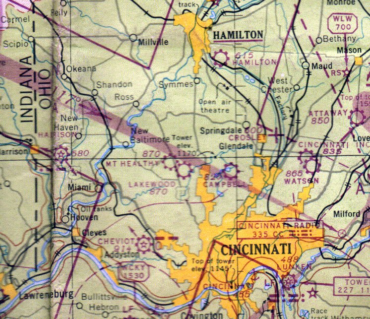
The airfield’s location in a flood plain was one geographical disadvantage and heavy fog and surrounding hilltops were others.  All these factors put a damper on serious thought to expand Lunken airport into a major airport.  Some civic leaders looked to the Blue Ash airfield location as the site of Cincinnati’s major airport.  Politicians and civic leaders engaged in internal feuding trying to decide where the main Cincinnati airport should be located.  Meanwhile, politicians in Northern Kentucky, sensing a great opportunity was at hand, met with Federal authorities and secured Federal funding to build an airfield in Northern Kentucky.  While Northern Kentucky officials rolled forward with their airport plans, Cincinnati officials were deadlocked in disagreement that lasted for decades.
 

In 1946, the major airlines began to pull out of Lunken and started operations at the "Greater Cincinnati Airport" located in Northern Kentucky.  Lunken continued expansion with corporations establishing their flight operations out of Lunken in 1951.  To date, most Cincinnati Corporations base their flight departments at Lunken. Throughout the years, Lunken Airport became known as a "reliever" airport, handling most General Aviation traffic operations in the Cincinnati area.  Admittedly, a small airplane operating at CVG is like riding a bicycle on I-75. Lunken also had its fair share of celebrity arrivals to include the Beatles and most of the US presidents.  Encroaching suburbs started complaining about noise and the airport found itself locked in many battles with the City of Cincinnati for funding and expansion that continue to this day.

Lunken airport is presently an 1140-acre airfield for General and Corporate Aviation, and attempts are made to bring in regional airlines and increase size limits for larger aircraft to land at the airport.  Still, expensive homes are being built on the hills directly facing the airport providing more and more property owners who litigate for tougher noise restrictions and less flight activity at the airport.  Unfortunately, Lunken Airport is again caught in the middle of a tug of war between hostile surrounding communities and a City Council which seems not to act in the airport’s best interest.

The Little Miami River to the East, Kellogg Ave and the Ohio River to the South, Wilmer Avenue to the West, and Beechmont Avenue to the North surround Lunken Airport.

Other interesting facts about Lunken.  The original course of the Little Miami River snaked through the middle of the present Lunken airfield.  One can see traces of the old riverbed in aerial photos of the field.  The Little Miami was rerouted to the East of the field and is separated from the airfield by a massive dike system. 

Lunken bike trail is a paved roadway/sidewalk that completely encircles the airfield for 5 miles used extensively by walkers/joggers and bicyclists.  The airfield literally sits atop the lands that were occupied by the first settlers in this region in 1788.   The small settlement of Columbia was established and the original cemetery is located across the street from the airport on Wilmer Avenue.  The settlement later moved downriver to Tusculum and later, further down to the location that became the City of Cincinnati.


Air operations at Lunken Airport can be monitored by scanner frequencies 118.7, 121.9, 121.0.

Copyright  CAHS 2004-2023 All Rights Reserved